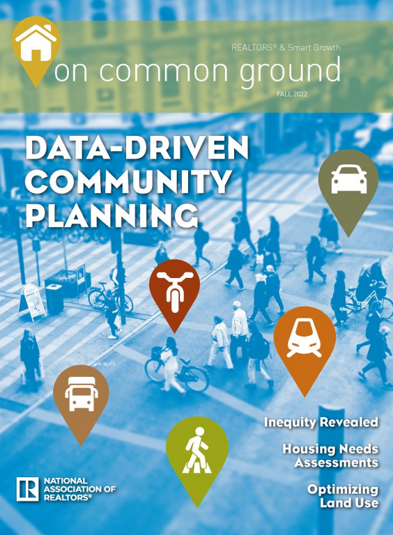
With urban planning and design attuning itself to meet the desires of today’s homebuyers, focusing largely on walkable communities offering equitable access to all amenities, so has the process of evaluating current park use, as well as locating the “park deserts” that need addressing — and big data is becoming integral to that process.
As reported in previous issues of this publication, green spaces in urban areas, small town Main Street and rural communities have greatly enhanced livability for locals and has served as a major factor in new homebuyer location decisions, as well as providing environmental benefits from combating urban heat zones and improving air quality to stormwater retention and carbon sequestration.
Big data is bringing a sharper picture of park use and need into focus.
The process of planning where and how many parks a community needs has relied chiefly on census data, conducting in-person counts and/or surveys at parks, and simple formulas based on human density in a given area. The result was often lacking in an equitable distribution of resources for the varying members of various parts of the country. Big data is bringing a sharper picture of use and need into focus.
The National Recreation and Parks Association (NRPA) is a leading nonprofit conservation organization that was formed in 1965 with a mission “to advance parks, recreation, and conservation efforts that enhance the quality of life for all people.” Kevin Roth, the vice president for research, evaluation and technology, explained the need for a new process of planning and assessing where parks needed to be located, and which existing parks needed to be improved.
“In the past there have been set standards about what a park and recreation agency should do, or even what should be in a park. It used to be that there was 10 acres of [park] land for every thousand residents. There were problems with those kinds of metrics. It kind of assumed that someone in Fairbanks, Alaska, or Key West, Fla., or Scarsdale, N.Y., all had the same needs and desires and, frankly, financial ability to pay for all that, and of course that assumption is…not realistic.
“So, what we did instead is we started to develop this benchmarking tool, and it was originally called something else, but now it’s Park Metrics. We have parks and recreation agencies that share a lot of information about their budgets, their staffing, the assets and infrastructure they manage, about acreage of land, the playground equipment, swimming pools, trail mileage, and all sorts of things. Even the programs they offer and some of their policies. The idea here is, that by plugging in all this information we can develop a reporting tool that agencies and professionals and their advocates and so forth can benchmark and compare themselves to other agencies of similar size, demographics, budget. It’s helped these agencies to aspire to move away from the one-size-fits-all mentality of the old standards to really kind of serving the needs of the community. There may not be a lot of demand for ice rinks in Key West or jai alai courts in Fairbanks, right?
“Park Metrics is also very helpful in the area of budgeting and staffing, which can be very challenging. There are ten thousand plus park and recreation agencies across the United States, and like their communities, they’re diverse, across the field. This data allows agencies to evaluate themselves to ensure that every member of the community is able to benefit from parks and recreation.”
Another major player helping preserve land for our recreation is the Trust for Public Land (TPL), a nonprofit formed in 1972 with the conviction that “all people need access to nature and the outdoors, close to home, in the cities and communities where they live, as a matter of health, equity, and justice.”
TPL uses big data to determine where to plan/put new green space, add to parks, or restructure existing facilities. Linda Hwang, senior director of strategy and innovation, explained that “TPL uses big data in a couple of different ways to help park agencies, city planners, and even local citizens determine where to site, design, improve and advocate for parks. First, we developed and maintain a data set of urban heat islands for every 30-meter-by-30-meter geographic area for every city in the contiguous United States. The data set shows where certain areas of cities are hotter than the average temperature for that same city as a whole. Using the Descartes Labs platform, we access NASA’s Landsat 8 thermal band data for U.S. towns, cities and census-designated places for the period from June 1 to Sept 30 each year. We’ve written software that converts thermal data into a heat value, expressed in degrees Fahrenheit, for every 30m x 30m area.
“Second, we include this urban heat island data into our ParkServe mapping application, which shows priority areas for new parks for 14,000 cities and towns. The park priority areas are based on population density, urban heat, household income, mental and physical health, race/ ethnicity, and air pollution burden. Our use of big data helps us and our partners deliberately focus our work in communities where parks are needed most, including addressing the effects of the climate crisis like severe heat.
“Third, to help improve access to quality parks and public lands, we purchase location data from reputable third-party vendors who contractually represent to us that they are authorized to obtain and share information with us. We do not combine location data with any personally-identifiable information such as names and home addresses, but we do combine location data with our own parks data and publicly-available, non-personal information from other sources including the U.S. Census. We aggregate this information and visualize it to show park visitation trends and patterns. This data helps park agencies justify the need for staff, maintenance, and additional park facilities and can provide guidance on how to better develop and deliver services and programming to help close the park equity gap.”
But TPL isn’t aggregating all the fine-grain data just for urban planning and design applications; they’ve developed a tool that’s useful for end-users called the ParkScore® index, which they describe as “the national gold-standard comparison of park systems across the 100 most populated cities in the United States. Published annually, the index measures park systems according to five categories: access, investment, amenities, acreage, equity.”
“While more than 500 organizations provide us with spatial and survey-based data related to park access, acreage, investment, and amenities, the ParkScore® index does not utilize big data to rank the park systems of the 100 most populated U.S. cities,” Hwang says. “ However the ParkScore® index does help park agencies with their planning in many ways, including making the case for more funding, highlighting which neighborhoods have park equity gaps, benchmarking against other cities, celebrating innovations and creative approaches to solving community challenges like extreme heat and flooding, and revealing potential partnerships, for example with the local school district, water management agency, or even private developer, that can help increase the number of people with park access.”
With the ubiquitous presence of cameras, sensors and other monitors of human activity becoming a part of our modern world, data can be gathered and assimilated from many sources. But one of the greatest contributors to the mapping of where we like to go and what we like to do is readily available to data mining companies such as Google, Facebook and Twitter from the location function on our cell phones to the comments and emojis that we post, known as ‘sentiment analysis.’
Dr. Jamie Saxon is a postdoctoral scholar at the Center for Data and Computing of the University of Chicago. He spoke with Adi Reske of Unacast recently, saying: “There is enormous potential for geolocation data in urban design. But to fully realize that promise — to measure and improve public spaces — we should complement GPS data with other data streams and tools.
“We all spend a lot of time cleaning, validating, and investigating data sets. I felt I had reached a tipping point with location data, when every ‘feature’ I investigated on the ground turned out to be true. It flipped from me teaching the data, to the data teaching me.”
The data allows us to evaluate and improve the equity and accessibility of urban neighborhoods.
Reske notes in his reporting that, “The data allows us to evaluate and improve the equity and accessibility of urban neighborhoods. It’s important for those responsible for delivering parks, public spaces, and other public services to integrate measurement and validation in their workflow. Otherwise, we risk perpetuating a cycle of ‘build it and they will come’ projects.”
But big data alone does not hold all the answers, as Roth explains, “The data generally will not have the answer embedded in it. It helps to greatly inform the decision. Let’s say a park and rec agency consults Park Metrics, and they pick some communities that sort of match where they are or where they want to be aspirationally, maybe the demographics of their community are a bit younger than the median across the country, with more school-aged children.
“What they may want to do is look at similar communities, rather than use the national benchmark in terms of how many playgrounds should be in a town per thousand residents, and they may find that their agency is underperforming and doesn’t have as many playgrounds as it should. That may give them the opportunity to say we’re a veteran community that has a lot of younger families that have younger children. A resource that they need here is to ensure that there is playground equipment that is acceptable and is within walking distance of the majority of the community.
“The data is also used for things such as budgets, especially about the area. A lot of agencies will charge for some of their services, maybe there’s a parking lot or there’s a registration fee for an event or a class. There’s a sense of cost recovery. Most agencies tend to be heavily reliant upon tax revenues to pay for a good chunk of their operating budgets. But there tend to be ratios that they recover through fees. So, they’ll use that data to compare themselves with other communities. Are they more reliant upon generated revenue than a typical agency? That can have an impact of causing some access issues, that some members aren’t able to access some park and recreational amenities because of cost, and so forth. And it needs to have walkable access, within 10 minutes of safe walking, not having to cross a highway or busy street to get there. That’s the difference between a park that’s serving the needs of the area or just a place that looks nice. Community engagement is critical.”
Park and recreation access is critical to most new homebuyers when deciding where to move.
While engagement is critical to the planning process, park and recreation access is critical to most new homebuyers when deciding where to move. “We do an annual survey of 1,000 U.S. adults,” Roth says. “It’s called our Engagement Parks Survey, and one of the questions we ask is about the importance of having high quality parks and recreation opportunities near them, and 84 percent of the people said that it’s an important factor in choosing where they want to live.”
REALTOR® research underscores the importance of parks and open space to a homebuyer. According to Sidnee Holmes, research associate for the NATIONAL ASSOCIATION OF REALTORS®, “The proximity and walkability to parks and other open areas is becoming an increasingly important selling point for residential real estate. For the sake of improving people’s overall quality of life, the real estate industry is witnessing an increase in the market demand for property.”
In NAR’s 2020 Community Preference Survey, more than three fourths of all respondents want to be within an easy walk to a park and 53 percent believe it’s important to be close to paths. And, more than half of them would be willing to pay more to buy a house within walking distance to amenities, such as parks.
“The notion that parks and open spaces have a positive impact on property values originates from the assessment that residents are frequently willing to pay a bit more money for a home that is located close to these types of areas, than they are for a comparable home that is further away.” Holmes said.
“This finding lends credence to the theory that parks and open spaces have a positive effect on property values. According to the 2021 NAR Profile of Home Buyers and Sellers, one quarter of all buyers cited the neighborhood’s proximity to parks and green spaces as a variable that influenced their choice of community. This type of data is useful because it demonstrates the current demand for natural, green spaces and parks as a required fixture in the planning of new communities,” Holmes added.
Roth concludes, that “Even during the first months of the pandemic, when everything was starting to close, most likely the local park and hiking trail were the last things to stay open. Yeah, it’s about fun and recreation for sure, but it’s also about mental and physical health.”
Parks and open space play an important role in everyone’s wellbeing. John Muir was prescient when he observed the need for places to heal the body and soul. Today, big data is further enabling planners and urban designers to see where to place parks, how they are used, and that we all have equal access to those places in our communities.


